
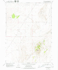
1968 Map of Monument Peak
USGS Topo · Published 1972About this map
Monument Peak serves as the focal point of this high-desert landscape in northern Utah, where the rugged topography of the Hansel Mountains gives way to expansive basins. The survey records a working landscape defined by sparse water resources and livestock management, evidenced by the presence of a Well and a Water Tank positioned near the transition from mountain to valley. This area, spanning the border of Curlew Valley and Sage Valley, reflects a mid-century period of land use where infrastructure was concentrated around cattle ranching and resource extraction. Distinct landmarks like Cedar Hill and Johnson Hill provide orientation across the sagebrush-covered terrain. Human activity is marked by functional features such as a Borrow Pit and a Storage Bin, which highlight the practical nature of development in this corner of Box Elder County during the late 1960s.
Find a feature on this map
11 named features on this map. Tap any name to fly to it.
Don’t see what you’re looking for? This feature index may not catch every label — zoom into the map to look around manually.
Map Details
Editions of this 1968 Monument Peak Map
2 editions found
Other maps of this area

1954 · Brigham City
USGS Topo · 1:250,000

1958 · Brigham City
USGS Topo · 1:250,000

1962 · Brigham City
USGS Topo · 1:250,000

1968 · Lake Ridge
USGS Topo · 1:24,000

1968 · Monument Point
USGS Topo · 1:24,000

1968 · Salt Wells
USGS Topo · 1:24,000

1968 · Monument Peak NW
USGS Topo · 1:24,000

1968 · Monument Peak SW
USGS Topo · 1:24,000

1968 · Snowville
USGS Topo · 1:24,000

1968 · Monument Peak NE
USGS Topo · 1:24,000