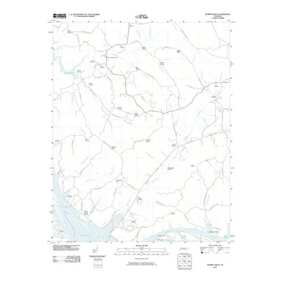
2010 Map of Bumpus Mills
USGS Topo · Published 2010About this map
Lake Barkley dominates the western and southern reaches of this landscape, its backwaters reaching deep into the winding valleys of Saline Creek and Hayes Fork Creek. This Cumberland River impoundment shapes the modern topography, surrounding Dover Island and creating a series of complex inlets and bays. Historically significant for its connection to the river economy, the area remains anchored by the Bumpus Mills Post Office and Big Rock Post Office, reflecting the dispersed nature of these Tennessee valley communities.
Find a feature on this map
94 named features on this map. Tap any name to fly to it.
Don’t see what you’re looking for? This feature index may not catch every label — zoom into the map to look around manually.
Map Details
Editions of this 2010 Bumpus Mills Map
This is the sole edition of this map. No revisions or reprints were ever made.
Other maps of this area

1931 · Erin
USGS Topo · 1:62,500

1936 · Tharpe
USGS Topo · 1:24,000

1936 · Standing Rock
USGS Topo · 1:24,000

1936 · Dover
USGS Topo · 1:24,000

1950 · Standing Rock
USGS Topo · 1:24,000

1950 · Dover
USGS Topo · 1:24,000

1951 · Model
USGS Topo · 1:24,000

1951 · Roaring Spring
USGS Topo · 1:24,000

1951 · Johnson Hollow
USGS Topo · 1:24,000
1951 · Tharpe
USGS Topo · 1:24,000