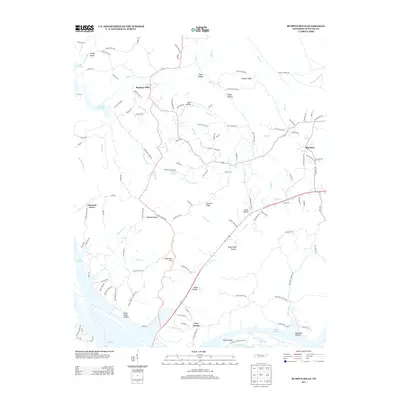
2013 Map of Bumpus Mills
USGS Topo · Published 2013About this map
Bumpus Mills and the surrounding reaches of Lake Barkley define this portion of Stewart County. The landscape is characterized by a dense network of hollows and ridges, such as Hargis Hollow and Walker Ridge, which channel numerous tributaries like Saline Cr and Hayes Fork Cr toward the main reservoir. These geographical features dictated the placement of small rural communities and family-named roads, including Big Rock and Chestnut Grove.
Find a feature on this map
132 named features on this map. Tap any name to fly to it.
Don’t see what you’re looking for? This feature index may not catch every label — zoom into the map to look around manually.
Map Details
Editions of this 2013 Bumpus Mills Map
This is the sole edition of this map. No revisions or reprints were ever made.
Other maps of this area

1931 · Erin
USGS Topo · 1:62,500

1936 · Tharpe
USGS Topo · 1:24,000

1936 · Standing Rock
USGS Topo · 1:24,000

1936 · Dover
USGS Topo · 1:24,000

1950 · Standing Rock
USGS Topo · 1:24,000

1950 · Dover
USGS Topo · 1:24,000

1951 · Model
USGS Topo · 1:24,000

1951 · Roaring Spring
USGS Topo · 1:24,000

1951 · Johnson Hollow
USGS Topo · 1:24,000
1951 · Tharpe
USGS Topo · 1:24,000