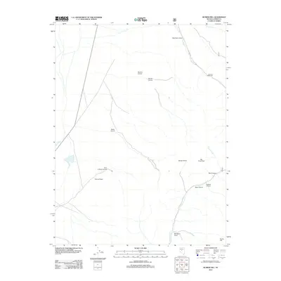
2012 Map of Bunker Hill
USGS Topo · Published 2012About this map
Bunker Hill and Big Creek Peak dominate this high-elevation terrain in Lander County, Nevada. The landscape is defined by deep drainages such as Big Creek Canyon and Sawmill Canyon, which channel seasonal water toward the valley floors. In the west, the Reese River flows through the lower elevations, while Kingston Creek and Porter Creek carve paths through the eastern slopes. This 2012 survey illustrates the remote character of the Toiyabe Range, where recreation and access are facilitated by Big Creek Rd leading to the Big Creek Campground. Named points of interest like the Point of Rocks and Mahogany Gulch provide specific landmarks for those navigating the transition from the river basin to the rugged peaks, reflecting a landscape still shaped by its natural topography and seasonal hydrology.
Find a feature on this map
19 named features on this map. Tap any name to fly to it.
Don’t see what you’re looking for? This feature index may not catch every label — zoom into the map to look around manually.
Map Details
Editions of this 2012 Bunker Hill Map
This is the sole edition of this map. No revisions or reprints were ever made.
Other maps of this area

1955 · Millett
USGS Topo · 1:250,000

1956 · North Shoshone Peak
USGS Topo · 1:62,500

1956 · Millett Ranch
USGS Topo · 1:62,500

1956 · Austin
USGS Topo · 1:62,500

1959 · Millett
USGS Topo · 1:250,000

1969 · Gandolfo Canyon
USGS Topo · 1:24,000

1969 · Dutch Flat
USGS Topo · 1:24,000

1985 · Smith Creek Valley
USGS Topo · 1:100,000
1988 · Austin
USGS Topo · 1:24,000
1988 · Bunker Hill
USGS Topo · 1:24,000