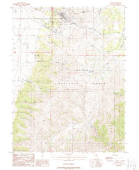
1988 Map of Austin
USGS Topo · Published 1988About this map
The silver-mining heritage of Austin is etched into the landscape of this late-1980s topographic survey. Situated between Pony Canyon and Marshall Canyon, the town is surrounded by a dense network of mining claims including the Jackpot Mine, Ophir Mine, and Baker Mine. The architectural landmark Stokes Castle sits on the western ridge overlooking the settlement, a reminder of the district's 19th-century boom.
Find a feature on this map
33 named features on this map. Tap any name to fly to it.
Don’t see what you’re looking for? This feature index may not catch every label — zoom into the map to look around manually.
Map Details
Editions of this 1988 Austin Map
This is the sole edition of this map. No revisions or reprints were ever made.
Other maps of this area

1926 · Roberts Mountains
USGS Topo · 1:250,000

1929 · Roberts Mountains
USGS Topo · 1:250,000

1955 · Millett
USGS Topo · 1:250,000

1956 · Mount Callaghan
USGS Topo · 1:62,500

1956 · Austin
USGS Topo · 1:62,500

1959 · Millett
USGS Topo · 1:250,000

1960 · Spencer Hot Springs
USGS Topo · 1:62,500

1969 · Yankee Blade
USGS Topo · 1:24,000

1969 · Vigus Butte
USGS Topo · 1:24,000

1978 · Summit Mountain
USGS Topo · 1:100,000