
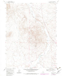
1969 Map of Vigus Butte
USGS Topo · Published 1971About this map
Jacobsville (Site) and Ledlie (Site) anchor this 1969 survey of the central Nevada desert, marking the footprints of former outposts in the high basin. The landscape is dominated by the massive Vigus Butte, surrounded by evidence of early industrial activity ranging from the Guenah Mine and Skookum Mine to various Gravel Pits. The Old Railroad Grade snakes through the valley parallel to the Reese River, illustrating the historical transportation network that once supported these remote mining and ranching operations.
Find a feature on this map
14 named features on this map. Tap any name to fly to it.
Don’t see what you’re looking for? This feature index may not catch every label — zoom into the map to look around manually.
Map Details
Editions of this 1969 Vigus Butte Map
2 editions found
Other maps of this area

1955 · Millett
USGS Topo · 1:250,000

1956 · Austin
USGS Topo · 1:62,500

1959 · Millett
USGS Topo · 1:250,000

1969 · Yankee Blade
USGS Topo · 1:24,000

1969 · Vigus Butte NE
USGS Topo · 1:24,000

1969 · Vigus Butte NW
USGS Topo · 1:24,000

1969 · Mount Airy NE
USGS Topo · 1:24,000

1969 · Gandolfo Canyon
USGS Topo · 1:24,000

1969 · Mount Airy Mesa
USGS Topo · 1:24,000

1983 · Edwards Creek Valley
USGS Topo · 1:100,000