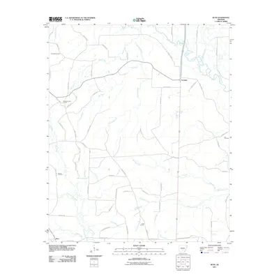
2011 Map of Bunn
USGS Topo · Published 2011About this map
Saline River and its dense network of tributaries, including Hurricane Creek and Barn Hill Creek, dominate the landscape of Dallas County in this 2011 survey. The settlement of Bunn sits in the southwestern corner, while Farindale serves as a central point of interest further north. The map reveals a rural landscape deeply connected to its local geography, with many roads named for the families and landmarks they connect, such as Sam Mac Rd, National Berry Rd, and Pinchback Rd.
Find a feature on this map
68 named features on this map. Tap any name to fly to it.
Don’t see what you’re looking for? This feature index may not catch every label — zoom into the map to look around manually.
Map Details
Editions of this 2011 Bunn Map
This is the sole edition of this map. No revisions or reprints were ever made.
Other maps of this area

1903 · Camden
USGS Topo · 1:125,000

1953 · El Dorado
USGS Topo · 1:250,000

1955 · Little Rock
USGS Topo · 1:250,000

1956 · Little Rock
USGS Topo · 1:250,000

1957 · El Dorado
USGS Topo · 1:250,000

1958 · El Dorado
USGS Topo · 1:250,000

1960 · El Dorado
USGS Topo · 1:250,000

1960 · Little Rock
USGS Topo · 1:250,000

1964 · Little Rock
USGS Topo · 1:250,000

1964 · Staves
USGS Topo · 1:24,000