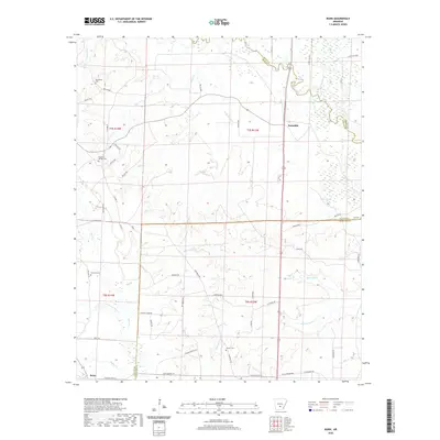
2020 Map of Bunn
USGS Topo · Published 2020About this map
The Saline River winds through the northeastern corner of this Dallas County landscape, defining the low-lying wetlands and complex drainage patterns around Mink Slough and Beech Cr. The settlement of Bunn anchors the southwestern reaches, situated near the intersection of Country Road 66 and Bunn McGriff Rd. For genealogists and local historians, this map provides precise locations for several family-named burial grounds, including Hardcastle Cem, Hampton Springs Cem, and Wright Cem. The terrain is characterized by a dense network of seasonal and perennial waterways like Moro Cr and Hurricane Cr, which have shaped the local road network and land use patterns over generations. Further north, the small community of Farindale sits along the road to the river, while landmarks like Barn Hill Cr and Cold Br offer points of reference in the timber-rich landscape of south-central Arkansas.
Find a feature on this map
70 named features on this map. Tap any name to fly to it.
Don’t see what you’re looking for? This feature index may not catch every label — zoom into the map to look around manually.
Map Details
Editions of this 2020 Bunn Map
This is the sole edition of this map. No revisions or reprints were ever made.
Other maps of this area

1903 · Camden
USGS Topo · 1:125,000

1953 · El Dorado
USGS Topo · 1:250,000

1955 · Little Rock
USGS Topo · 1:250,000

1956 · Little Rock
USGS Topo · 1:250,000

1957 · El Dorado
USGS Topo · 1:250,000

1958 · El Dorado
USGS Topo · 1:250,000

1960 · El Dorado
USGS Topo · 1:250,000

1960 · Little Rock
USGS Topo · 1:250,000

1964 · Little Rock
USGS Topo · 1:250,000

1964 · Staves
USGS Topo · 1:24,000