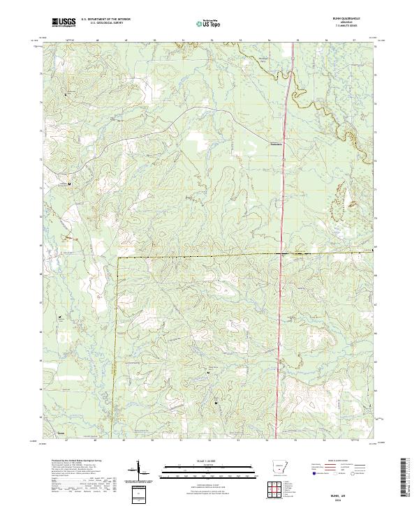
2024 Map of Bunn
USGS Topo · Published 2024About this map
The Saline River corridor defines the eastern reaches of this landscape, where the Mornings Ferry crossing once linked the timber-rich bottomlands of Dallas and Grant counties. The area is characterized by a dense network of creeks, including Beech Creek, Cane Creek, and Cow Head Creek, which feed into the larger river system. Small communities like Farindale and Bunn serve as local anchors, connected by a web of rural roads such as Hastings Camp Rd and Pinchback Rd. For genealogists and local historians, the map is a primary record of rural family life, preserving the locations of several burial grounds. These include the Hampton Springs Cem near the western edge and Shady Grove Cem situated central to the township, along with Hardcastle Cem and Wright Cem. The presence of features like Mink Slough and Hurricane Creek underscores the hydrological complexity of this part of Arkansas.
Find a feature on this map
68 named features on this map. Tap any name to fly to it.
Don’t see what you’re looking for? This feature index may not catch every label — zoom into the map to look around manually.
Map Details
Editions of this 2024 Bunn Map
This is the sole edition of this map. No revisions or reprints were ever made.
Other maps of this area

1903 · Camden
USGS Topo · 1:125,000

1953 · El Dorado
USGS Topo · 1:250,000

1955 · Little Rock
USGS Topo · 1:250,000

1956 · Little Rock
USGS Topo · 1:250,000

1957 · El Dorado
USGS Topo · 1:250,000

1958 · El Dorado
USGS Topo · 1:250,000

1960 · El Dorado
USGS Topo · 1:250,000

1960 · Little Rock
USGS Topo · 1:250,000

1964 · Little Rock
USGS Topo · 1:250,000

1964 · Staves
USGS Topo · 1:24,000