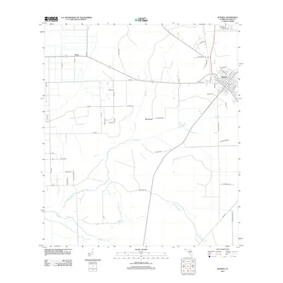
2012 Map of Bunnell
USGS Topo · Published 2012About this map
Bunnell serves as a central hub in this survey, showcasing its layout just east of the expansive wetlands and drainage networks of Flagler County. The town's grid is anchored by essential community features like the local Po (Post Office) and the Hope Cem, while the historic N Old Dixie Hwy skirts the northern edge of the settlement. The landscape to the west and south is dominated by a complex hydrological system, where Haw Cr and Middle Haw Cr provide the primary drainage. Smaller tributaries such as Sweetwater Br, Black Branch, and Little Black Br carve through the terrain, illustrating the low-lying coastal geography. Outlying settlements like Bimini and Black Point mark the transition from the concentrated town center to the surrounding agricultural and rural tracts, connected by a network of county roads.
Find a feature on this map
58 named features on this map. Tap any name to fly to it.
Don’t see what you’re looking for? This feature index may not catch every label — zoom into the map to look around manually.
Map Details
Editions of this 2012 Bunnell Map
This is the sole edition of this map. No revisions or reprints were ever made.
Other maps of this area

1927 · Matanzas
USGS Topo · 1:48,000

1937 · Dinner Island
USGS Topo · 1:48,000

1937 · Ormond
USGS Topo · 1:48,000

1943 · Dinner Island
USGS Topo · 1:62,500

1943 · Matanzas
USGS Topo · 1:62,500

1944 · Ormond
USGS Topo · 1:62,500

1944 · Dinner Island
USGS Topo · 1:62,500

1944 · Matanzas
USGS Topo · 1:62,500

1954 · Daytona Beach
USGS Topo · 1:250,000

1956 · Favoretta
USGS Topo · 1:24,000