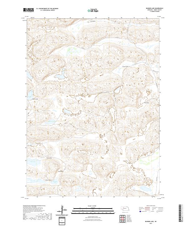
2021 Map of Bunner Lake
USGS Topo · Published 2021About this map
The Nebraska Sandhills define this portion of Grant County, characterized by a complex network of dry valleys and isolated wetlands typical of the region's unique hydrology. Named basins such as Long Valley, Hardy Valley, and Pratt Valley corridor through the landscape, separated by the undulating dunes of the t23n r37w and t23n r36w townships. These valleys provide the primary routes for local travel, including Husker Ln and S Whitman Rd.
Find a feature on this map
20 named features on this map. Tap any name to fly to it.
Don’t see what you’re looking for? This feature index may not catch every label — zoom into the map to look around manually.
Map Details
Editions of this 2021 Bunner Lake Map
This is the sole edition of this map. No revisions or reprints were ever made.
Other maps of this area

1948 · Carr Lake
USGS Topo · 1:62,500

1948 · Whitman
USGS Topo · 1:62,500

1948 · Spring Valley
USGS Topo · 1:62,500

1950 · Spring Valley
USGS Topo · 1:62,500

1950 · Whitman
USGS Topo · 1:62,500

1950 · Carr Lake
USGS Topo · 1:62,500

1950 · Hire
USGS Topo · 1:62,500

1954 · North Platte
USGS Topo · 1:250,000

1956 · North Platte
USGS Topo · 1:250,000

1957 · North Platte
USGS Topo · 1:250,000