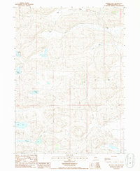
1985 Map of Bunner Lake
USGS Topo · Published 1986About this map
Isolated family outposts like Buchfinck Ranch and Bunner Ranch define this pocket of the Nebraska Sandhills in the mid-1980s. The landscape is a complex system of dunes and depressions, where numerous small, unnamed water bodies cluster around the larger Bunner Lake and Anderson Lake. The settlement pattern is sparse, consisting of established ranching operations and named locations such as Flats Place and Dyer Ranch that served as local landmarks in an otherwise repeating terrain of valleys. Distinctive natural corridors like Long Valley and Hardy Valley cut through the sand hills, providing the primary orientation for travel between the scattered lakes, including Round Lake, Pratt Lake, and Williams Lake. This survey captures the region just before the shift to more modern digital mapping, documenting the traditional landholdings and water access points essential to High Plains ranching life.
Find a feature on this map
14 named features on this map. Tap any name to fly to it.
Don’t see what you’re looking for? This feature index may not catch every label — zoom into the map to look around manually.
Map Details
Editions of this 1985 Bunner Lake Map
This is the sole edition of this map. No revisions or reprints were ever made.
Other maps of this area

1948 · Carr Lake
USGS Topo · 1:62,500

1948 · Whitman
USGS Topo · 1:62,500

1948 · Spring Valley
USGS Topo · 1:62,500

1950 · Spring Valley
USGS Topo · 1:62,500

1950 · Whitman
USGS Topo · 1:62,500

1950 · Carr Lake
USGS Topo · 1:62,500

1950 · Hire
USGS Topo · 1:62,500

1954 · North Platte
USGS Topo · 1:250,000

1956 · North Platte
USGS Topo · 1:250,000

1957 · North Platte
USGS Topo · 1:250,000