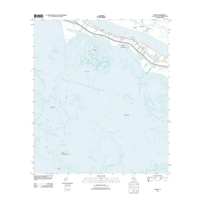
2012 Map of Buras
USGS Topo · Published 2012About this map
The Mississippi River shapes the life and industry of Plaquemines Parish, where the communities of Buras and Sunrise line the narrow strip of land between the river and the marsh. This 2012 landscape is a complex network of man-made and natural waterways, including the Cognevich Canal and Easterlings Canal, which support a local economy heavily tied to the water. The map reveals the extensive industrial footprint in the wetlands, highlighted by the Bastian Bay Oil and Gas Field and the West Bastian Bay Oil and Gas Field.
Find a feature on this map
54 named features on this map. Tap any name to fly to it.
Don’t see what you’re looking for? This feature index may not catch every label — zoom into the map to look around manually.
Map Details
Editions of this 2012 Buras Map
This is the sole edition of this map. No revisions or reprints were ever made.
Other maps of this area

1892 · Quarantine
USGS Topo · 1:62,500

1893 · Forts
USGS Topo · 1:62,500

1893 · West Delta
USGS Topo · 1:62,500

1935 · Port Sulphur
USGS Topo · 1:31,680

1935 · Bastian Bay
USGS Topo · 1:31,680

1935 · Tropical Bend
USGS Topo · 1:31,680

1941 · Empire
USGS Topo · 1:62,500

1944 · Empire
USGS Topo · 1:62,500

1946 · Pass Tante Phine
USGS Topo · 1:31,680

1947 · Buras
USGS Topo · 1:31,680