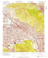
1953 Map of Burbank
USGS Topo · Published 1955About this map
Burbank and the surrounding San Fernando Valley stand at a midpoint of industrial and entertainment growth during the early 1950s. The map highlights the significant footprint of the film industry, documenting the Walt Disney Studio, Warner Brothers Studio, and Universal International Studio near the Los Angeles River. Aviation history is also prominently featured, with the expansive Lockheed Air Terminal and the Grand Central Airport serving as major hubs for the region's burgeoning aerospace sector.
Find a feature on this map
122 named features on this map. Tap any name to fly to it.
Don’t see what you’re looking for? This feature index may not catch every label — zoom into the map to look around manually.
Map Details
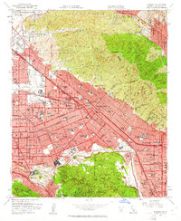
Editions of this 1953 Burbank Map
2 editions found
Other maps of this area

1894 · Los Angeles
USGS Topo · 1:62,500

1896 · Pasadena
USGS Topo · 1:62,500

1896 · Santa Monica
USGS Topo · 1:62,500

1898 · Santa Monica
USGS Topo · 1:62,500

1900 · Pasadena
USGS Topo · 1:62,500

1900 · Tujunga
USGS Topo · 1:62,500

1900 · Los Angeles
USGS Topo · 1:62,500

1900 · Fernando
USGS Topo · 1:62,500

1901 · Southern California Sheet No. 1
USGS Topo · 1:250,000

1902 · Santa Monica
USGS Topo · 1:62,500