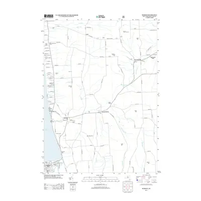
2013 Map of Burdett
USGS Topo · Published 2013About this map
Seneca Lake shores define the western edge of this 2013 survey, where the deep glens of the Finger Lakes region meet the agricultural plateaus of Schuyler County. The landscape is heavily influenced by viticulture and family-run operations, with Atwater Estate Vineyards, Rasta Ranch Vineyards and Nursery, and Mangus Vineyards positioned along the slopes leading down to the water. The historic village of Burdett serves as a local hub, situated near the dramatic drop of Hector Falls Creek. This map captures a rural network of small settlements like Logan, Bennettsburg, and Reynoldsville, each maintaining its own community character through local landmarks such as Union Cemetery and Backbone Trailhead. Further south, the map details the entrance to the famous Watkins Glen area, including Excelsior Glen and waterfront facilities like Lembeck's Marina and Glen Harbor Marina.
Find a feature on this map
101 named features on this map. Tap any name to fly to it.
Don’t see what you’re looking for? This feature index may not catch every label — zoom into the map to look around manually.
Map Details
Editions of this 2013 Burdett Map
This is the sole edition of this map. No revisions or reprints were ever made.
Other maps of this area

1893 · Ithaca
USGS Topo · 1:62,500

1895 · Ithaca
USGS Topo · 1:62,500

1898 · Watkins Glen
USGS Topo · 1:62,500

1901 · Watkins
USGS Topo · 1:62,500

1902 · Genoa
USGS Topo · 1:62,500

1902 · Ovid
USGS Topo · 1:62,500

1905 · Watkins Glen
USGS Topo · 1:125,000

1942 · Dundee
USGS Topo · 1:24,000

1942 · Lodi
USGS Topo · 1:24,000

1942 · Trumansburg
USGS Topo · 1:24,000