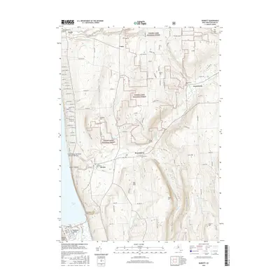
2016 Map of Burdett
USGS Topo · Published 2016About this map
Finger Lakes National Forest covers the high ground above the eastern shores of Seneca Lake, where the Finger Lakes region’s characteristic glacial landscape creates deep drainages and dramatic elevation changes. The agricultural plateau around Hector and Logan transitions into the protected woodlands of the Backbone, intersected by the N Country National Scenic Trail. This area preserves several mid-19th-century religious and civic sites, including the Hector Presbyterian Church and its neighboring Hector Presbyterian Cem.
Find a feature on this map
122 named features on this map. Tap any name to fly to it.
Don’t see what you’re looking for? This feature index may not catch every label — zoom into the map to look around manually.
Map Details
Editions of this 2016 Burdett Map
This is the sole edition of this map. No revisions or reprints were ever made.
Other maps of this area

1893 · Ithaca
USGS Topo · 1:62,500

1895 · Ithaca
USGS Topo · 1:62,500

1898 · Watkins Glen
USGS Topo · 1:62,500

1901 · Watkins
USGS Topo · 1:62,500

1902 · Genoa
USGS Topo · 1:62,500

1902 · Ovid
USGS Topo · 1:62,500

1905 · Watkins Glen
USGS Topo · 1:125,000

1942 · Dundee
USGS Topo · 1:24,000

1942 · Lodi
USGS Topo · 1:24,000

1942 · Trumansburg
USGS Topo · 1:24,000