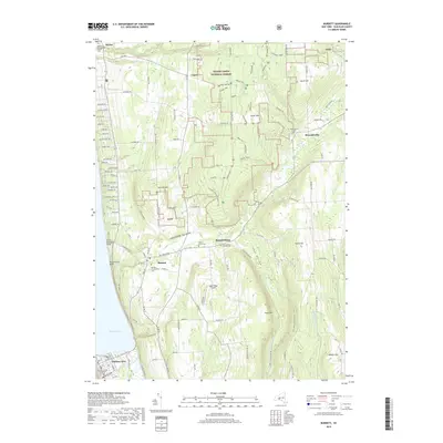
2019 Map of Burdett
USGS Topo · Published 2019About this map
Seneca Lake defines the western edge of this Schuyler County landscape, where steep ravines and glacial valleys descend from high ridges toward the water. The village of Burdett sits at a historic crossroads just east of Hector Falls Point, while the southern end of the map covers the northern reaches of Watkins Glen, including the Schuyler County Courthouse. This area is characterized by significant public lands within the Finger Lakes National Forest, where former agricultural lands have transitioned into managed forest and recreational space.
Find a feature on this map
114 named features on this map. Tap any name to fly to it.
Don’t see what you’re looking for? This feature index may not catch every label — zoom into the map to look around manually.
Map Details
Editions of this 2019 Burdett Map
This is the sole edition of this map. No revisions or reprints were ever made.
Other maps of this area

1893 · Ithaca
USGS Topo · 1:62,500

1895 · Ithaca
USGS Topo · 1:62,500

1898 · Watkins Glen
USGS Topo · 1:62,500

1901 · Watkins
USGS Topo · 1:62,500

1902 · Genoa
USGS Topo · 1:62,500

1902 · Ovid
USGS Topo · 1:62,500

1905 · Watkins Glen
USGS Topo · 1:125,000

1942 · Dundee
USGS Topo · 1:24,000

1942 · Lodi
USGS Topo · 1:24,000

1942 · Trumansburg
USGS Topo · 1:24,000