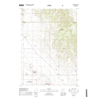
2017 Map of Burdock
USGS Topo · Published 2017About this map
Burdock and Marietta anchor the western edge of this South Dakota landscape, where the high prairie of the Buffalo Gap National Grassland meets the timbered rises of the Black Hills National Forest. The Cheyenne River winds through the southern half of the quadrangle, supported by an irrigation network including the Griffis Canal and Tubbs Canal. These waterways were essential to the ranching and agricultural operations established in Fall River County and Custer County.
Find a feature on this map
35 named features on this map. Tap any name to fly to it.
Don’t see what you’re looking for? This feature index may not catch every label — zoom into the map to look around manually.
Map Details
Editions of this 2017 Burdock Map
This is the sole edition of this map. No revisions or reprints were ever made.
Other maps of this area

1896 · Harney Peak
USGS Topo · 1:125,000

1899 · Newcastle
USGS Topo · 1:125,000

1901 · Harney Peak
USGS Topo · 1:125,000

1901 · Newcastle
USGS Topo · 1:125,000

1902 · Edgemont
USGS Topo · 1:125,000

1950 · Edgemont
USGS Topo · 1:24,000

1950 · Edgemont SW
USGS Topo · 1:24,000

1950 · Burdock
USGS Topo · 1:24,000

1950 · Edgemont NE
USGS Topo · 1:24,000

1951 · Dewey
USGS Topo · 1:24,000