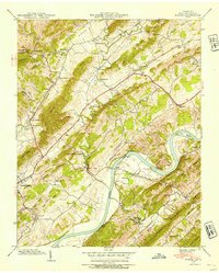
1939 Map of Burem
USGS Topo · Published 1954About this map
Hickory Cove Valley and the surrounding Tennessee hills define this 1939 survey, capturing a rural landscape transitioning between traditional agrarian life and the infrastructure improvements of the early twentieth century. The community of Rogersville serves as the local anchor in the southwest, while the Holston River meanders through the heart of the terrain, framing Burem Island and Miller Island. A remarkable natural curiosity, the Ebbing and Flowing Spring, is documented near the riverbank, an area also served by the Southern railroad and the Burem Bridge.
Find a feature on this map
77 named features on this map. Tap any name to fly to it.
Don’t see what you’re looking for? This feature index may not catch every label — zoom into the map to look around manually.
Map Details
Editions of this 1939 Burem Map
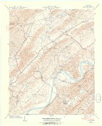
2 editions found
Other maps of this area

1883 · Morristown
USGS Topo · 1:125,000

1887 · Jonesville
USGS Topo · 1:125,000

1891 · Jonesville
USGS Topo · 1:125,000

1892 · Greeneville
USGS Topo · 1:125,000

1893 · Morristown
USGS Topo · 1:125,000

1894 · Estillville
USGS Topo · 1:125,000

1895 · Morristown
USGS Topo · 1:125,000

1896 · Greeneville
USGS Topo · 1:125,000

1904 · Greeneville
USGS Topo · 1:125,000

1935 · Surgoinsville
USGS Topo · 1:48,000