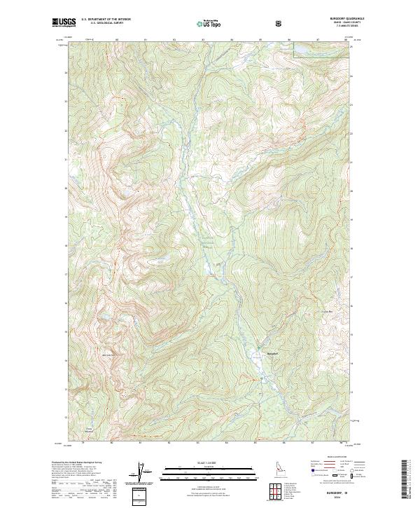
2024 Map of Burgdorf
USGS Topo · Published 2024About this map
Burgdorf sits at the heart of this high-elevation mountain landscape, serving as a historic nexus for travelers and recreation within the Payette National Forest. The settlement is famously associated with the nearby Hot Springs, which have long drawn visitors to this remote corner of Idaho. The terrain is defined by significant peaks such as Bear Pete Mtn and Crystal Mtn, with a network of high-country drainage systems including Burgdorf Creek and Nethker Creek flowing toward the Secesh River.
Find a feature on this map
54 named features on this map. Tap any name to fly to it.
Don’t see what you’re looking for? This feature index may not catch every label — zoom into the map to look around manually.
Map Details
Editions of this 2024 Burgdorf Map
This is the sole edition of this map. No revisions or reprints were ever made.
Other maps of this area

1938 · Riggins
USGS Topo · 1:96,000

1945 · Riggins
USGS Topo · 1:125,000

1955 · Grangeville
USGS Topo · 1:250,000

1956 · Burgdorf
USGS Topo · 1:62,500

1956 · Elk City
USGS Topo · 1:250,000

1959 · Grangeville
USGS Topo · 1:250,000

1960 · Elk City
USGS Topo · 1:250,000

1963 · Black Tip
USGS Topo · 1:24,000

1963 · Hershey Point
USGS Topo · 1:24,000
1964 · Kelly Mountain
USGS Topo · 1:24,000