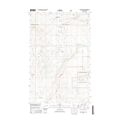
2014 Map of Burge Mountain
USGS Topo · Published 2014About this map
Okanogan National Forest defines the geography of this northern Washington landscape, where high peaks and seasonal water sources dictate the pattern of settlement. In the southern half of the quadrangle, Antoine Valley provides relatively level ground for ranching and homesteads, connected by rural routes like Havillah Rd. This 2014 survey reveals a transition from these valley lowlands to the higher elevations of Burge Mtn and Haley Mtn.
Find a feature on this map
65 named features on this map. Tap any name to fly to it.
Don’t see what you’re looking for? This feature index may not catch every label — zoom into the map to look around manually.
Map Details
Editions of this 2014 Burge Mountain Map
This is the sole edition of this map. No revisions or reprints were ever made.
Other maps of this area

1902 · Osoyoos
USGS Topo · 1:125,000

1904 · Osoyoos
USGS Topo · 1:125,000

1954 · Okanogan
USGS Topo · 1:250,000

1957 · Mt. Bonaparte
USGS Topo · 1:62,500

1957 · Tonasket
USGS Topo · 1:62,500

1957 · Oroville
USGS Topo · 1:62,500

1957 · Aeneas Valley
USGS Topo · 1:62,500

1958 · Okanogan
USGS Topo · 1:250,000

1975 · Oroville NW
USGS Topo · 1:24,000
1981 · Tonasket
USGS Topo · 1:24,000