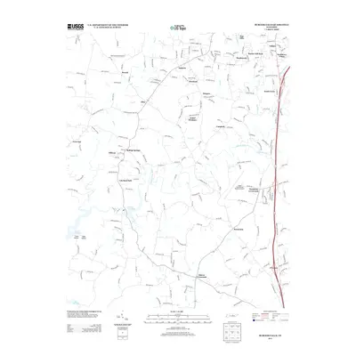
2013 Map of Burgess Falls
USGS Topo · Published 2013About this map
Falling Water River carves a winding path through the heart of this Putnam County landscape, feeding into Burgess Falls Lake and eventually the eastern reaches of Center Hill Lake. The 2013 topography reveals a network of small, established communities and crossroads that define the region's social geography, including Hamptons Crossroads, Macedonia, and Bussell. Transport and infrastructure are represented by the Upper Cumberland Regional Airport and smaller private airstrips like One Grand Field Airport. The map documents a transition from residential clusters like Amber Meadows and Lakeland Park to the deep incisions of Cane Hollow and Tibbs Hollow. These hollows and the rugged course of Cane Cr illustrate the drainage patterns that have shaped the rural settlement of this Tennessee plateau.
Find a feature on this map
200 named features on this map. Tap any name to fly to it.
Don’t see what you’re looking for? This feature index may not catch every label — zoom into the map to look around manually.
Map Details
Editions of this 2013 Burgess Falls Map
This is the sole edition of this map. No revisions or reprints were ever made.
Other maps of this area

1892 · Pikeville
USGS Topo · 1:125,000

1893 · Mc Minnville
USGS Topo · 1:125,000

1895 · Mc Minnville
USGS Topo · 1:125,000

1895 · Pikeville
USGS Topo · 1:125,000

1897 · Standingstone
USGS Topo · 1:125,000

1898 · Standingstone
USGS Topo · 1:125,000

1943 · Cookeville
USGS Topo · 1:100,000

1944 · Cookeville
USGS Topo · 1:100,000

1953 · Chattanooga
USGS Topo · 1:250,000

1953 · Cookeville East
USGS Topo · 1:24,000