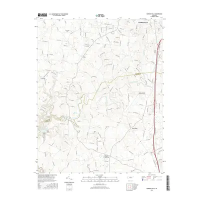
2016 Map of Burgess Falls
USGS Topo · Published 2016About this map
Burgess Falls Lake and its dramatic namesake waterfall, Burgess Falls, define the central landscape of this Putnam and White County border region. The Falling Water River flows through the center of the sheet, carving a path toward Center Hill Lake in the southwest. The terrain is characterized by intricate drainage systems including Cane Creek, Hudgens Creek, and Post Oak Creek, interspersed with local landmarks like Hickey Ridge and Tibbs Hollow.
Find a feature on this map
162 named features on this map. Tap any name to fly to it.
Don’t see what you’re looking for? This feature index may not catch every label — zoom into the map to look around manually.
Map Details
Editions of this 2016 Burgess Falls Map
This is the sole edition of this map. No revisions or reprints were ever made.
Other maps of this area

1892 · Pikeville
USGS Topo · 1:125,000

1893 · Mc Minnville
USGS Topo · 1:125,000

1895 · Mc Minnville
USGS Topo · 1:125,000

1895 · Pikeville
USGS Topo · 1:125,000

1897 · Standingstone
USGS Topo · 1:125,000

1898 · Standingstone
USGS Topo · 1:125,000

1943 · Cookeville
USGS Topo · 1:100,000

1944 · Cookeville
USGS Topo · 1:100,000

1953 · Chattanooga
USGS Topo · 1:250,000

1953 · Cookeville East
USGS Topo · 1:24,000