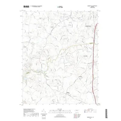
2019 Map of Burgess Falls
USGS Topo · Published 2019About this map
Cookeville serves as the regional anchor on this Tennessee landscape, where the plateau terrain is deeply incised by the Falling Water River and its dramatic Burgess Falls. The settlement pattern reflects a mix of modern infrastructure, such as the Upper Cumberland Regional Airport, and long-standing rural communities like Ditty, Macedonia, and Bakers Crossroads. Genealogists will find a wealth of local burial sites, including Hitchcock Cem, Dobbs Cem, and Harris Cem, many situated along winding rural routes like Burgess Falls Rd. The county line between Putnam Co and White Co traverses the southern portion of the map, cutting through the rugged drainage of Tibbs Hollow and Cane Hollow. This modern survey documents the persistent rural character of the region alongside the expanding influence of the nearby city.
Find a feature on this map
165 named features on this map. Tap any name to fly to it.
Don’t see what you’re looking for? This feature index may not catch every label — zoom into the map to look around manually.
Map Details
Editions of this 2019 Burgess Falls Map
This is the sole edition of this map. No revisions or reprints were ever made.
Other maps of this area

1892 · Pikeville
USGS Topo · 1:125,000

1893 · Mc Minnville
USGS Topo · 1:125,000

1895 · Mc Minnville
USGS Topo · 1:125,000

1895 · Pikeville
USGS Topo · 1:125,000

1897 · Standingstone
USGS Topo · 1:125,000

1898 · Standingstone
USGS Topo · 1:125,000

1943 · Cookeville
USGS Topo · 1:100,000

1944 · Cookeville
USGS Topo · 1:100,000

1953 · Chattanooga
USGS Topo · 1:250,000

1953 · Cookeville East
USGS Topo · 1:24,000