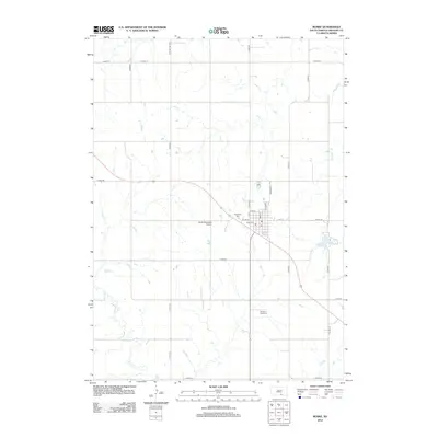
2012 Map of Burke
USGS Topo · Published 2012About this map
Burke serves as the central hub of this Gregory County landscape, oriented around a grid that includes Main St, Lincoln St, and Franklin St. The township-and-range surveying system is clearly visible here, with numerous county roads such as Co Hwy-17, Co Hwy-8, and Co Hwy-34 defining the agricultural and transport corridors of the region.
Find a feature on this map
30 named features on this map. Tap any name to fly to it.
Don’t see what you’re looking for? This feature index may not catch every label — zoom into the map to look around manually.
Map Details
Editions of this 2012 Burke Map
This is the sole edition of this map. No revisions or reprints were ever made.
Other maps of this area

1955 · Mitchell
USGS Topo · 1:250,000

1959 · Mitchell
USGS Topo · 1:250,000

1964 · Gregory SE
USGS Topo · 1:24,000

1964 · Herrick NW
USGS Topo · 1:24,000

1964 · Gregory
USGS Topo · 1:24,000
1964 · Herrick
USGS Topo · 1:24,000
1964 · Carlock
USGS Topo · 1:24,000
1964 · Burke
USGS Topo · 1:24,000

1971 · Dixon SW
USGS Topo · 1:24,000

1971 · Lucas
USGS Topo · 1:24,000