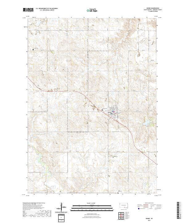
2021 Map of Burke
USGS Topo · Published 2021About this map
Burke serves as a central hub in this portion of Gregory County, where the local street grid is anchored by the Gregory County Courthouse. The map reveals a landscape defined by agricultural sections and the drainage patterns of Ponca Cr and Coon Creek. Several cemeteries scattered across the township, including Cournoyer Cem and Sacred Heart Cem, indicate long-standing community roots and family histories tied to the land. The proximity of Graceland Cem to the town center and the outlying County Home Cem suggests a shift from rural homesteading toward a more concentrated municipal development in the early 21st century. This survey documents the intersection of local section roads with state transit corridors, illustrating the rural-to-town transition typical of the South Dakota plains.
Find a feature on this map
58 named features on this map. Tap any name to fly to it.
Don’t see what you’re looking for? This feature index may not catch every label — zoom into the map to look around manually.
Map Details
Editions of this 2021 Burke Map
This is the sole edition of this map. No revisions or reprints were ever made.
Other maps of this area

1955 · Mitchell
USGS Topo · 1:250,000

1959 · Mitchell
USGS Topo · 1:250,000

1964 · Gregory SE
USGS Topo · 1:24,000

1964 · Herrick NW
USGS Topo · 1:24,000

1964 · Gregory
USGS Topo · 1:24,000
1964 · Herrick
USGS Topo · 1:24,000
1964 · Carlock
USGS Topo · 1:24,000
1964 · Burke
USGS Topo · 1:24,000

1971 · Dixon SW
USGS Topo · 1:24,000

1971 · Lucas
USGS Topo · 1:24,000