
1953 Map of Burkesville
USGS Topo · Published 1955About this map
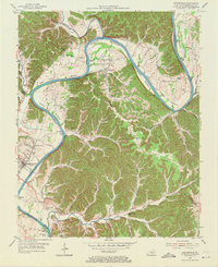
Burkesville serves as the focal point of this mid-century survey, situated along a sharp bend of the Cumberland River in southern Kentucky. The river dominates the landscape, creating expansive alluvial flats known as bottoms, including Howards Bottom, Steele Bottom, and Irish Bottom. These fertile areas supported a network of small rural communities and institutions, such as Bakerton and Holly Grove. The map reveals a post-war landscape still tied to its rural roots, evidenced by the high density of country schools like Howards Bottom Sch and Irish Bottom Sch.
Find a feature on this map
64 named features on this map. Tap any name to fly to it.
Don’t see what you’re looking for? This feature index may not catch every label — zoom into the map to look around manually.
Map Details
Editions of this 1953 Burkesville Map
2 editions found
Other maps of this area

1924 · Lillydale
USGS Topo · 1:62,500

1926 · Lillydale
USGS Topo · 1:62,500

1929 · Lillydale
USGS Topo · 1:62,500

1929 · Byrdstown
USGS Topo · 1:62,500

1953 · Breeding
USGS Topo · 1:24,000

1953 · Waterview
USGS Topo · 1:24,000

1953 · Amandaville
USGS Topo · 1:24,000

1953 · Wolf Creek Dam
USGS Topo · 1:24,000

1953 · Creelsboro
USGS Topo · 1:24,000

1954 · Frogue
USGS Topo · 1:24,000