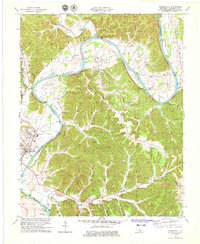
1978 Map of Burkesville
USGS Topo · Published 1979About this map
Cumberland River curves through this part of southern Kentucky, shaping the agricultural and industrial landscape around Burkesville. In the late 1970s, the region shows a distinct pattern of small, ridge-top settlements and river-bottom farming tracts like Howards Bottom, Steele Bottom, and Scotts Bottom. The prevalence of scattered Oil Wells across the hillsides indicates a persistent local energy industry, while the concentration of community life remains centered on rural houses of worship such as Bakerton Ch, Terry Chapel, and Smith Grove Ch. Beyond the county seat, smaller hubs like Bakerton and Dougan Town anchor the local road network. The map detail reflects a transition from river-dependent trade to a modern upland economy, with the Burkesville Bridge providing a critical crossing for travelers on KY 61.
Find a feature on this map
51 named features on this map. Tap any name to fly to it.
Don’t see what you’re looking for? This feature index may not catch every label — zoom into the map to look around manually.
Map Details
Editions of this 1978 Burkesville Map
2 editions found
Other maps of this area

1924 · Lillydale
USGS Topo · 1:62,500

1926 · Lillydale
USGS Topo · 1:62,500

1929 · Lillydale
USGS Topo · 1:62,500

1929 · Byrdstown
USGS Topo · 1:62,500

1953 · Breeding
USGS Topo · 1:24,000

1953 · Waterview
USGS Topo · 1:24,000

1953 · Amandaville
USGS Topo · 1:24,000

1953 · Burkesville
USGS Topo · 1:24,000

1953 · Wolf Creek Dam
USGS Topo · 1:24,000

1953 · Creelsboro
USGS Topo · 1:24,000