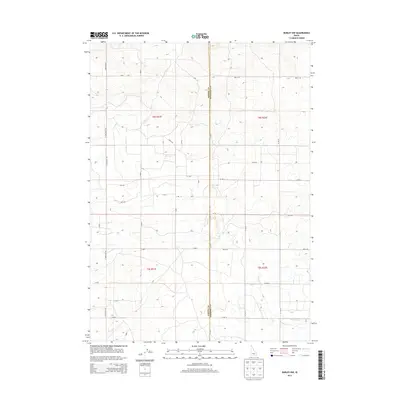
2013 Map of Burley NW
USGS Topo · Published 2013About this map
Agricultural irrigation networks define the landscape at the junction of Jerome Co and Minidoka Co during this 2013 survey. The terrain is structured by a rigid section-line road grid and significant water management infrastructure, most notably the E E Main Drain in the northwest and the N Main Drain in the southeast. These man-made channels are critical to the region's productivity, supporting the high-desert farms that stretch between S Crestview Rd and the eastern county line. While the map lacks traditional town centers, the density of numbered rural roads like 175 S Rd and 300 N Rd illustrates a highly organized rural settlement pattern where every quarter-section is integrated into the regional water and transport system.
Find a feature on this map
38 named features on this map. Tap any name to fly to it.
Don’t see what you’re looking for? This feature index may not catch every label — zoom into the map to look around manually.
Map Details
Editions of this 2013 Burley NW Map
This is the sole edition of this map. No revisions or reprints were ever made.
Other maps of this area

1954 · Pocatello
USGS Topo · 1:250,000

1955 · Twin Falls
USGS Topo · 1:250,000

1958 · Twin Falls
USGS Topo · 1:250,000

1958 · Pocatello
USGS Topo · 1:250,000

1964 · Burley SW
USGS Topo · 1:24,000

1964 · Burley NE
USGS Topo · 1:24,000

1964 · Burley NW
USGS Topo · 1:24,000

1964 · Milner
USGS Topo · 1:24,000

1964 · Hazelton NE
USGS Topo · 1:24,000

1964 · Burley SE
USGS Topo · 1:24,000