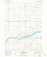
1964 Map of Burley SW
USGS Topo · Published 1978About this map
Snake River waters define this region of southern Idaho, where the construction of the Milner Lake reservoir supports an extensive irrigation network. This survey, updated in the late 1970s, captures a landscape transformed by water management, featuring various canals and laterals like the Unit A Main Canal and Milner Lateral. The importance of water to the local economy is evidenced by multiple pumping facilities, including the Unit A Pumping Sta and the P A Lateral Pumping Sta.
Find a feature on this map
31 named features on this map. Tap any name to fly to it.
Don’t see what you’re looking for? This feature index may not catch every label — zoom into the map to look around manually.
Map Details
Editions of this 1964 Burley SW Map
2 editions found
Other maps of this area

1954 · Pocatello
USGS Topo · 1:250,000

1955 · Twin Falls
USGS Topo · 1:250,000

1958 · Twin Falls
USGS Topo · 1:250,000

1958 · Pocatello
USGS Topo · 1:250,000

1964 · Burley SW
USGS Topo · 1:24,000

1964 · Burley NE
USGS Topo · 1:24,000

1964 · Kenyon
USGS Topo · 1:24,000

1964 · Burley NW
USGS Topo · 1:24,000

1964 · Milner
USGS Topo · 1:24,000

1964 · Hazelton NE
USGS Topo · 1:24,000