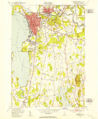
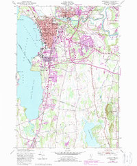
1948 Map of Burlington
USGS Topo · Published 1953About this map
The post-war urban landscape of Burlington and Winooski is documented in this 1948 survey, showing a transition from the industrial waterfront to expanding suburban neighborhoods. The city's rail-dependent history is anchored by the Rutland and Central Vermont lines, which converge near Union Sta and the bustling downtown core near City Hall. Educational and military institutions are prominent fixtures on the landscape, with the sprawling University of Vermont campus and the Fort Ethan Allen Military Reservation serving as major regional hubs.
Find a feature on this map
62 named features on this map. Tap any name to fly to it.
Don’t see what you’re looking for? This feature index may not catch every label — zoom into the map to look around manually.
Map Details
Editions of this 1948 Burlington Map
5 editions found
Other maps of this area

1894 · Plattsburg
USGS Topo · 1:62,500

1895 · Willsboro
USGS Topo · 1:62,500

1906 · Plattsburg
USGS Topo · 1:62,500

1906 · Burlington
USGS Topo · 1:62,500

1913 · Milton
USGS Topo · 1:48,000

1915 · Milton
USGS Topo · 1:62,500

1919 · Burlington
USGS Topo · 1:62,500

1939 · Plattsburg
USGS Topo · 1:62,500

1941 · Plattsburg
USGS Topo · 1:62,500

1941 · Willsboro
USGS Topo · 1:62,500