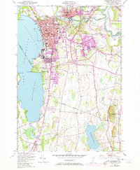
1948 Map of Burlington
USGS Topo · Published 1973About this map
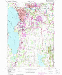
The eastern shores of Lake Champlain define this mid-century portrait of Vermont’s largest city and its industrial surroundings. The downtown grid of Burlington shows a dense concentration of civic life, including the City Hall, Post Office, and Courthouse, while the northern waterfront is marked by industrial infrastructure like Gas Tanks and a Refinery. To the east, the Winooski River carves through the landscape at the Winooski Gorge, where the historic presence of a Lime Kiln and several Quarries point to the area's long-standing extractive industries.
Find a feature on this map
62 named features on this map. Tap any name to fly to it.
Don’t see what you’re looking for? This feature index may not catch every label — zoom into the map to look around manually.
Map Details
Editions of this 1948 Burlington Map
5 editions found
Other maps of this area

1894 · Plattsburg
USGS Topo · 1:62,500

1895 · Willsboro
USGS Topo · 1:62,500

1906 · Plattsburg
USGS Topo · 1:62,500

1906 · Burlington
USGS Topo · 1:62,500

1913 · Milton
USGS Topo · 1:48,000

1915 · Milton
USGS Topo · 1:62,500

1919 · Burlington
USGS Topo · 1:62,500

1939 · Plattsburg
USGS Topo · 1:62,500

1941 · Plattsburg
USGS Topo · 1:62,500

1941 · Willsboro
USGS Topo · 1:62,500