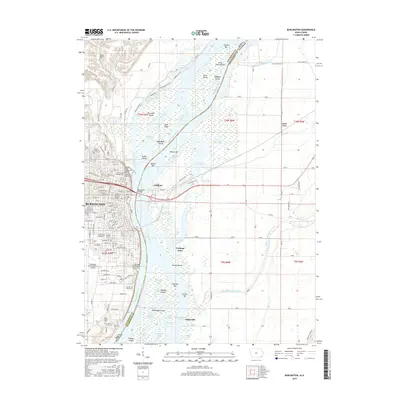
2015 Map of Burlington
USGS Topo · Published 2015About this map
Burlington dominates the western bank of the Mississippi River, showcasing a dense grid of streets and historical landmarks connected by the MacArthur Bridge to Gulfport on the Illinois side. This 2015 survey reveals a landscape shaped by both urban development and the river's dynamic hydrology, where islands like Burlington Island and Otter Island sit amidst a complex network of chutes and sloughs. Genealogists will find significant value in the documentation of numerous burial sites, including the large Aspen Grove Cem, the Sixth Street Catholic Cem, and smaller private family locations such as the Meyers Family Plot and Cowles Farm Plot. To the east, the Illinois bottomlands are defined by drainage projects like the Ellison Creek Diverson Ditch, reflecting the long-term engineering required to manage this fertile river valley for agriculture and settlement.
Find a feature on this map
82 named features on this map. Tap any name to fly to it.
Don’t see what you’re looking for? This feature index may not catch every label — zoom into the map to look around manually.
Map Details
Editions of this 2015 Burlington Map
This is the sole edition of this map. No revisions or reprints were ever made.
Other maps of this area

1918 · La Harpe
USGS Topo · 1:62,500

1932 · Lomax
USGS Topo · 1:62,500

1934 · Oquawka
USGS Topo · 1:48,000

1934 · Burlington
USGS Topo · 1:48,000

1937 · Lomax
USGS Topo · 1:62,500

1940 · Oquawka
USGS Topo · 1:62,500

1940 · Burlington
USGS Topo · 1:62,500

1958 · Burlington
USGS Topo · 1:250,000

1961 · Burlington
USGS Topo · 1:250,000

1963 · Burlington
USGS Topo · 1:250,000