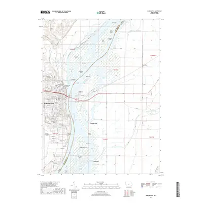
2018 Map of Burlington
USGS Topo · Published 2018About this map
The city of Burlington dominates the western bank of the Mississippi River, where the BNSF Railway and MacArthur Bridge connect Iowa and Illinois. This 2018 survey reveals a landscape shaped by both urban development and the shifting currents of the river, with numerous islands like O'Connell Island and Burlington Island divided by complex side channels including Rush Chute and O'Connell Slough.
Find a feature on this map
121 named features on this map. Tap any name to fly to it.
Don’t see what you’re looking for? This feature index may not catch every label — zoom into the map to look around manually.
Map Details
Editions of this 2018 Burlington Map
This is the sole edition of this map. No revisions or reprints were ever made.
Other maps of this area

1918 · La Harpe
USGS Topo · 1:62,500

1932 · Lomax
USGS Topo · 1:62,500

1934 · Oquawka
USGS Topo · 1:48,000

1934 · Burlington
USGS Topo · 1:48,000

1937 · Lomax
USGS Topo · 1:62,500

1940 · Oquawka
USGS Topo · 1:62,500

1940 · Burlington
USGS Topo · 1:62,500

1958 · Burlington
USGS Topo · 1:250,000

1961 · Burlington
USGS Topo · 1:250,000

1963 · Burlington
USGS Topo · 1:250,000