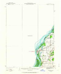
1934 Map of Burlington
USGS Topo · Published 1963About this map
The Mississippi River forms a complex network of backwaters and islands along the border of Iowa and Illinois, characterized by a shifting aquatic landscape. West of the main channel, much of the terrain is noted as an Unsurveyed Area, while the eastern Illinois side shows a developed rural grid across Gladstone, Carman, and Stronghurst. The settlement of Gulfport sits at a critical junction where the Chicago Burlington and Quincy railroad crosses the river, connecting the agricultural hinterlands to the larger market. This 1930s landscape is dotted with localized social hubs, specifically small country schools such as Merry Dell Sch, Crystal Lake Sch, and Kirby Sch. The presence of the Diversion Ditch and numerous named lakes like Carthage Lake and Orchard City Lake indicates significant early water management efforts to utilize the fertile but flood-prone bottomlands.
Find a feature on this map
28 named features on this map. Tap any name to fly to it.
Don’t see what you’re looking for? This feature index may not catch every label — zoom into the map to look around manually.
Map Details
Editions of this 1934 Burlington Map
2 editions found
Other maps of this area

1918 · La Harpe
USGS Topo · 1:62,500

1932 · Lomax
USGS Topo · 1:62,500

1934 · Oquawka
USGS Topo · 1:48,000

1934 · Burlington
USGS Topo · 1:48,000

1935 · Keithsburg
USGS Topo · 1:48,000

1936 · Fort Madison
USGS Topo · 1:62,500

1937 · Lomax
USGS Topo · 1:62,500

1940 · Oquawka
USGS Topo · 1:62,500

1940 · Burlington
USGS Topo · 1:62,500

1941 · Keithsburg
USGS Topo · 1:62,500