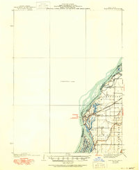
1940 Map of Burlington
USGS Topo · Published 1950About this map
The Mississippi River dominates this mid-century landscape, defining the border between Des Moines and Henderson counties. On the Iowa side, the city of Burlington sits across from the Illinois town of Gulfport, connected by a hub of transportation activity including the Chicago Burlington and Quincy railroad. The river's complex hydrology is visible through numerous backwaters and channels like Shokokon Slough, Stony Point Lake, and Jordan Chute.
Find a feature on this map
30 named features on this map. Tap any name to fly to it.
Don’t see what you’re looking for? This feature index may not catch every label — zoom into the map to look around manually.
Map Details
Editions of this 1940 Burlington Map
3 editions found
Other maps of this area

1918 · La Harpe
USGS Topo · 1:62,500

1932 · Lomax
USGS Topo · 1:62,500

1934 · Oquawka
USGS Topo · 1:48,000

1934 · Burlington
USGS Topo · 1:48,000

1935 · Keithsburg
USGS Topo · 1:48,000

1936 · Fort Madison
USGS Topo · 1:62,500

1937 · Lomax
USGS Topo · 1:62,500

1940 · Oquawka
USGS Topo · 1:62,500

1940 · Burlington
USGS Topo · 1:62,500

1941 · Keithsburg
USGS Topo · 1:62,500