
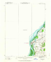
1934 Map of Burlington
USGS Topo · Published 1934About this map
The Mississippi River dominates this mid-1930s survey, defining the border between Illinois and Iowa with an intricate network of chutes, sloughs, and islands. This environment shaped a cluster of riverside settlements and transit points, including Gulfport and Orchard City, positioned where the Chicago Burlington and Quincy railroad crosses the floodplains. The map reveals the hydraulic complexity of the era, showing how the Diversion Channel and Old Channel redirected the flow near Whitehead Island.
Find a feature on this map
37 named features on this map. Tap any name to fly to it.
Don’t see what you’re looking for? This feature index may not catch every label — zoom into the map to look around manually.
Map Details
Editions of this 1934 Burlington Map
2 editions found
Other maps of this area

1918 · La Harpe
USGS Topo · 1:62,500

1932 · Lomax
USGS Topo · 1:62,500

1934 · Oquawka
USGS Topo · 1:48,000

1935 · Keithsburg
USGS Topo · 1:48,000

1936 · Fort Madison
USGS Topo · 1:62,500

1937 · Lomax
USGS Topo · 1:62,500

1940 · Oquawka
USGS Topo · 1:62,500

1940 · Burlington
USGS Topo · 1:62,500

1941 · Keithsburg
USGS Topo · 1:62,500

1946 · Wapello
USGS Topo · 1:62,500