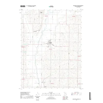
2017 Map of Burlington Junction
USGS Topo · Published 2017About this map
Burlington Junction serves as the central hub of this Missouri landscape, where the local road network converges near the banks of Cuyhoga Cr. The terrain is defined by the winding course of the Nodaway River, which carves through the undulating countryside, accompanied by smaller tributaries like Mill Cr and Muddy Cr. This area of Nodaway County preserves a significant record of early settlement and genealogy through its numerous burial grounds, including the Ohio Cem and Mount Hope Cem. Farther south, the community of Quitman is documented alongside several distinct sites of local remembrance, such as the Old Quitman Cem and Lamar Cem. The presence of several small-scale water management features, such as the Hoover Frankum Watershed B 20 Reservoir and Hoover Frankum Watershed B 23 Lake, highlights the agricultural engineering of the region during this era.
Find a feature on this map
67 named features on this map. Tap any name to fly to it.
Don’t see what you’re looking for? This feature index may not catch every label — zoom into the map to look around manually.
Map Details
Editions of this 2017 Burlington Junction Map
This is the sole edition of this map. No revisions or reprints were ever made.
Other maps of this area

1939 · Skidmore
USGS Topo · 1:62,500

1940 · Coin
USGS Topo · 1:62,500

1940 · New Market
USGS Topo · 1:62,500

1941 · Skidmore
USGS Topo · 1:62,500

1942 · Skidmore
USGS Topo · 1:62,500

1943 · Coin
USGS Topo · 1:62,500

1943 · Maryville
USGS Topo · 1:62,500

1943 · New Market
USGS Topo · 1:62,500

1955 · Nebraska City
USGS Topo · 1:250,000

1957 · Nebraska City
USGS Topo · 1:250,000