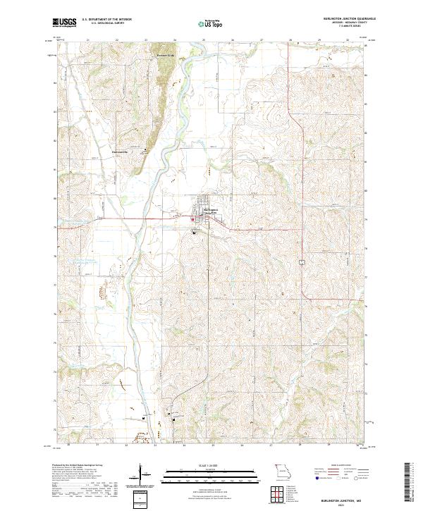
2021 Map of Burlington Junction
USGS Topo · Published 2021About this map
Burlington Junction serves as the primary hub in this corner of Northwest Missouri, where the street grid is anchored by W Main St and Roseberry Ave. The surrounding landscape is defined by the winding course of the Nodaway River, which carves through the undulating terrain alongside numerous tributaries like Cuyhoga Cr and Muddy Cr. This 2021 survey preserves the locations of several small, distinct communities and crossroads, including Dawsonville and Possum Walk, that offer points of interest for local history researchers.
Find a feature on this map
55 named features on this map. Tap any name to fly to it.
Don’t see what you’re looking for? This feature index may not catch every label — zoom into the map to look around manually.
Map Details
Editions of this 2021 Burlington Junction Map
This is the sole edition of this map. No revisions or reprints were ever made.
Other maps of this area

1939 · Skidmore
USGS Topo · 1:62,500

1940 · Coin
USGS Topo · 1:62,500

1940 · New Market
USGS Topo · 1:62,500

1941 · Skidmore
USGS Topo · 1:62,500

1942 · Skidmore
USGS Topo · 1:62,500

1943 · Coin
USGS Topo · 1:62,500

1943 · Maryville
USGS Topo · 1:62,500

1943 · New Market
USGS Topo · 1:62,500

1955 · Nebraska City
USGS Topo · 1:250,000

1957 · Nebraska City
USGS Topo · 1:250,000