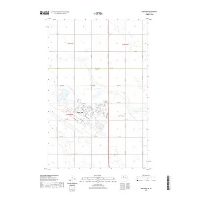
2020 Map of Burlington NE
USGS Topo · Published 2020About this map
Minot Air Force Base occupies a significant portion of the landscape north of the Minot Afb settlement, defining the area's modern identity. The street names within the base reflect its strategic defense history, with roads designated as Missile Ave, Bomber Blvd, Cruise Missile Ln, and Minuteman Dr. Beyond the military installation, the terrain transitions into the agricultural plains characteristic of the North Dakota borderlands near the Renville Co Ward Co boundary. Water features like Egg Cr and Little Deep Cr drain this northern prairie, while the Lynch Immanuel Lutheran Church Cem stands as a quiet marker of local community heritage. The map documents the grid-based rural road system, from 74th St NW down to 142nd Ave NE, illustrating how military infrastructure and traditional farming coexist in this corner of the state.
Find a feature on this map
50 named features on this map. Tap any name to fly to it.
Don’t see what you’re looking for? This feature index may not catch every label — zoom into the map to look around manually.
Map Details
Editions of this 2020 Burlington NE Map
This is the sole edition of this map. No revisions or reprints were ever made.
Other maps of this area

1948 · Burlington
USGS Topo · 1:24,000

1948 · Lansford
USGS Topo · 1:62,500

1948 · Burlington
USGS Topo · 1:62,500

1948 · Lansford SW
USGS Topo · 1:24,000

1949 · Burlington NW
USGS Topo · 1:24,000

1949 · Glenburn
USGS Topo · 1:24,000

1949 · Lansford SW
USGS Topo · 1:24,000

1949 · Deering NW
USGS Topo · 1:24,000

1949 · Deering SW
USGS Topo · 1:24,000

1949 · Lansford SE
USGS Topo · 1:24,000