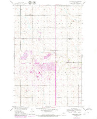
1979 Map of Burlington NE
USGS Topo · Published 1980About this map
Minot Air Force Base dominates the southern landscape of this northern North Dakota quadrangle, displaying the extensive infrastructure of the military facility as it appeared in the late 1970s. The base straddles the township line between Van Buren and Waterford, showcasing residential housing, technical facilities, and a Golf Course. Surrounding the base, the landscape maintains its agricultural character, defined by a sparse network of section-line roads and rural institutions such as Lynch Ch and several numbered district schools, including Copeland School No 1. The natural drainage of the prairie is marked by Little Deep Creek and Egg Creek, which meander through the terrain. Evidence of the region's transportation history is preserved in the Burlington Northern railroad line cutting across the southeastern corner of the map near a prominent Radio Tower.
Find a feature on this map
15 named features on this map. Tap any name to fly to it.
Don’t see what you’re looking for? This feature index may not catch every label — zoom into the map to look around manually.
Map Details
Editions of this 1979 Burlington NE Map
2 editions found
Other maps of this area

1948 · Burlington
USGS Topo · 1:24,000

1948 · Lansford
USGS Topo · 1:62,500

1948 · Burlington
USGS Topo · 1:62,500

1948 · Lansford SW
USGS Topo · 1:24,000

1949 · Burlington NW
USGS Topo · 1:24,000

1949 · Glenburn
USGS Topo · 1:24,000

1949 · Lansford SW
USGS Topo · 1:24,000

1949 · Deering NW
USGS Topo · 1:24,000

1949 · Deering SW
USGS Topo · 1:24,000

1949 · Lansford SE
USGS Topo · 1:24,000