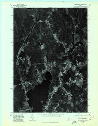
1975 Map of Burnham NE
USGS Topo · Published 1980About this map
Unity Pond dominates the southern landscape of this 1975 orthophotoquad, its dark expanse contrasting sharply with the surrounding patchwork of small agricultural clearings and dense Maine woodland. This aerial perspective, captured in the mid-1970s, reveals the rural spatial organization of Waldo County, where small clusters of development like Reynolds Corner and Greens Corner are situated at key road intersections. The map provides a detailed view of the land-use patterns of the era, showing the relationship between established farmsteads, secondary roads, and the shoreline near Oakland. This specific type of photographic survey offers a clear look at forest boundaries and field structures as they existed before subsequent decades of regrowth or development altered the Waldo County terrain.
Find a feature on this map
4 named features on this map. Tap any name to fly to it.
Don’t see what you’re looking for? This feature index may not catch every label — zoom into the map to look around manually.
Map Details
Editions of this 1975 Burnham NE Map
This is the sole edition of this map. No revisions or reprints were ever made.
Other maps of this area

1926 · Burnham
USGS Topo · 1:62,500

1930 · Pittsfield
USGS Topo · 1:48,000

1931 · Stetson
USGS Topo · 1:48,000

1932 · Brooks
USGS Topo · 1:62,500

1932 · Pittsfield
USGS Topo · 1:62,500

1933 · Pittsfield
USGS Topo · 1:62,500

1935 · Stetson
USGS Topo · 1:62,500

1948 · Bangor
USGS Topo · 1:250,000

1955 · Pittsfield
USGS Topo · 1:62,500

1955 · Brooks
USGS Topo · 1:62,500