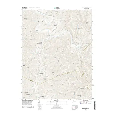
2014 Map of Burning Springs
USGS Topo · Published 2014About this map
The Burning Springs Oil Field dominates the northern reaches of this West Virginia landscape, marking a region deeply tied to early petroleum history along the Little Kanawha River. The river winds through the terrain, bridged at Sanoma Bridge and the Creston Bridge, with the Creston Ferry providing a crossing point at the settlement of Creston. The area is characterized by a dense network of family and community landmarks, including the Rector Cem, Beaty Cem, and Mt Pleasant Cem, which speak to the deep-rooted genealogy of the local valley settlements.
Find a feature on this map
122 named features on this map. Tap any name to fly to it.
Don’t see what you’re looking for? This feature index may not catch every label — zoom into the map to look around manually.
Map Details
Editions of this 2014 Burning Springs Map
This is the sole edition of this map. No revisions or reprints were ever made.
Other maps of this area

1906 · Elizabeth
USGS Topo · 1:62,500

1907 · Harrisville
USGS Topo · 1:62,500

1907 · Arnoldsburg
USGS Topo · 1:62,500

1907 · Spencer
USGS Topo · 1:62,500

1924 · Harrisville
USGS Topo · 1:62,500

1924 · Elizabeth
USGS Topo · 1:62,500

1925 · Arnoldsburg
USGS Topo · 1:62,500

1926 · Elizabeth
USGS Topo · 1:62,500

1926 · Harrisville
USGS Topo · 1:62,500

1927 · Arnoldsburg
USGS Topo · 1:62,500