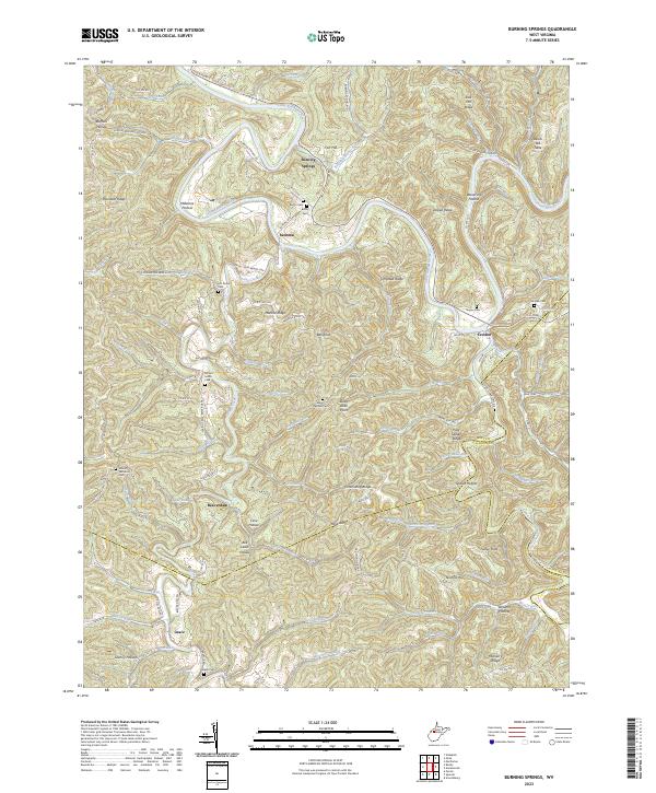
2023 Map of Burning Springs
USGS Topo · Published 2023About this map
The Little Kanawha River winds deeply through the borderlands of Wirt, Calhoun, and Roane counties, anchoring a landscape where small settlements like Burning Springs and Creston follow the river's path. This modern survey illustrates the rugged topography of the West Virginia hills, defined by prominent elevations such as Ball Knob and Salk Hill Ridge. The map is particularly dense with small family and community burial grounds, including Rector Cem, Beatty Cem, and McCrae Cem, which speak to the long-standing genealogical roots of this rural area. Local infrastructure is marked by a network of winding county routes and secondary roads like Burning Springs Rd and Sonoma Rd, connecting scattered locales such as Grace and Sanoma to the larger river valleys.
Find a feature on this map
126 named features on this map. Tap any name to fly to it.
Don’t see what you’re looking for? This feature index may not catch every label — zoom into the map to look around manually.
Map Details
Editions of this 2023 Burning Springs Map
This is the sole edition of this map. No revisions or reprints were ever made.
Historical Maps of Millard Through Time
4 maps found