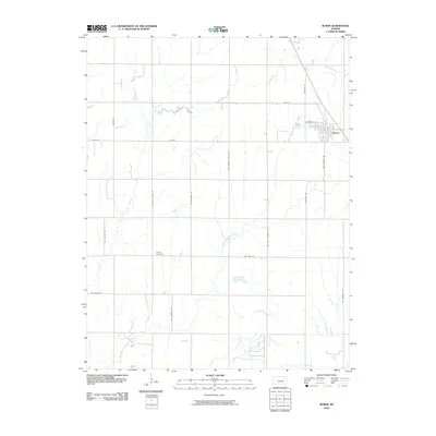
2010 Map of Burns
USGS Topo · Published 2010About this map
The town of Burns anchors the northeast corner of this Marion County landscape, showing a classic Great Plains grid at the intersection of Zebulon Rd and Cemetery Ln. The surrounding countryside is defined by the winding course of the East Branch Whitewater River and its tributary, May Branch, which meander through an orderly township-and-range road network. Local history is etched into the names of these routes, including NW Hopkins Switch Rd, which hints at the area’s railroad heritage, and NW Purity Springs Rd. Farther south, the secluded Clifford Cemetery sits along NW Ohio Street Rd, serving as a quiet genealogical marker for the families who settled this agricultural region. The map captures the enduring rural character of the Kansas prairie, where the modern landscape remains tied to the section lines established over a century ago.
Find a feature on this map
21 named features on this map. Tap any name to fly to it.
Don’t see what you’re looking for? This feature index may not catch every label — zoom into the map to look around manually.
Map Details
Editions of this 2010 Burns Map
This is the sole edition of this map. No revisions or reprints were ever made.
Other maps of this area

1888 · Eldorado
USGS Topo · 1:125,000

1889 · Newton
USGS Topo · 1:125,000

1889 · Wichita
USGS Topo · 1:125,000

1894 · Wichita
USGS Topo · 1:125,000

1894 · Newton
USGS Topo · 1:125,000

1898 · Cottonwood Falls
USGS Topo · 1:125,000

1955 · Wichita
USGS Topo · 1:250,000

1955 · Hutchinson
USGS Topo · 1:250,000

1957 · Florence
USGS Topo · 1:24,000

1957 · Wonsevu
USGS Topo · 1:24,000