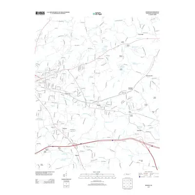
2013 Map of Burns
USGS Topo · Published 2013About this map
Montgomery Bell State Park anchors the eastern side of this Dickson County landscape, where the geography is defined by a dense network of hollows and small water bodies. The community of Burns sits centrally, established along the rail line near Railroad St and the headwaters of Beaverdam Cr. To the south and west, the terrain transitions into a series of named valleys and ridges, including Kaiser Hollow, Langford Hollow, and The Punch Bowl.
Find a feature on this map
109 named features on this map. Tap any name to fly to it.
Don’t see what you’re looking for? This feature index may not catch every label — zoom into the map to look around manually.
Map Details
Editions of this 2013 Burns Map
This is the sole edition of this map. No revisions or reprints were ever made.
Other maps of this area

1901 · Colombia
USGS Topo · 1:125,000

1930 · White Bluff
USGS Topo · 1:62,500

1933 · White Bluff
USGS Topo · 1:62,500

1936 · Texas Hollow
USGS Topo · 1:24,000

1936 · Burns
USGS Topo · 1:24,000

1936 · Craigfield
USGS Topo · 1:24,000

1936 · Lyles
USGS Topo · 1:24,000

1936 · Dickson
USGS Topo · 1:24,000
1952 · Texas Hollow
USGS Topo · 1:24,000

1953 · Dickson
USGS Topo · 1:24,000