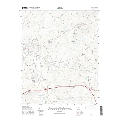
2016 Map of Burns
USGS Topo · Published 2016About this map
Dickson stands as the primary hub in this central Tennessee landscape, where the Tennessee Valley Divide snakes through the topography near Colesburg and Burns. The area is defined by its numerous family-named hollows and watercourses, such as Creech Hollow and Wildcat Hollow, illustrating a long history of rural settlement and local landownership. Small communities and railway points like Reeders Crossing and Tidwell are connected by a network of county roads and rail lines that navigate the uneven terrain.
Find a feature on this map
194 named features on this map. Tap any name to fly to it.
Don’t see what you’re looking for? This feature index may not catch every label — zoom into the map to look around manually.
Map Details
Editions of this 2016 Burns Map
This is the sole edition of this map. No revisions or reprints were ever made.
Other maps of this area

1901 · Colombia
USGS Topo · 1:125,000

1930 · White Bluff
USGS Topo · 1:62,500

1933 · White Bluff
USGS Topo · 1:62,500

1936 · Texas Hollow
USGS Topo · 1:24,000

1936 · Burns
USGS Topo · 1:24,000

1936 · Craigfield
USGS Topo · 1:24,000

1936 · Lyles
USGS Topo · 1:24,000

1936 · Dickson
USGS Topo · 1:24,000
1952 · Texas Hollow
USGS Topo · 1:24,000

1953 · Dickson
USGS Topo · 1:24,000