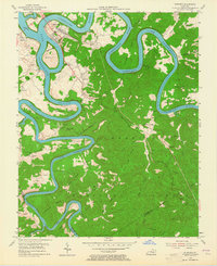
1954 Map of Burnside
USGS Topo · Published 1965About this map
Lake Cumberland dominates the landscape of southern Pulaski County in the mid-1950s, its winding waters filling the deep valleys of the Cumberland River and its South Fork. The town of Burnside sits at the confluence, serving as a primary hub where the Southern railroad crosses the water near the Antioch Bend. This survey documents a critical period following the creation of the reservoir, showing the normal pool elevation at 723 feet and the numerous named bends like Woodson Bend and Dixie Bend that became prominent peninsulas.
Find a feature on this map
74 named features on this map. Tap any name to fly to it.
Don’t see what you’re looking for? This feature index may not catch every label — zoom into the map to look around manually.
Map Details
Editions of this 1954 Burnside Map
2 editions found

Other maps of this area

1890 · Williamsburg
USGS Topo · 1:125,000

1893 · London
USGS Topo · 1:125,000

1894 · Williamsburg
USGS Topo · 1:125,000

1897 · London
USGS Topo · 1:125,000

1932 · Burnside
USGS Topo · 1:62,500

1935 · Somerset
USGS Topo · 1:62,500

1952 · Hail
USGS Topo · 1:24,000

1952 · Wiborg
USGS Topo · 1:24,000

1952 · Dykes
USGS Topo · 1:24,000

1953 · Frazer
USGS Topo · 1:24,000