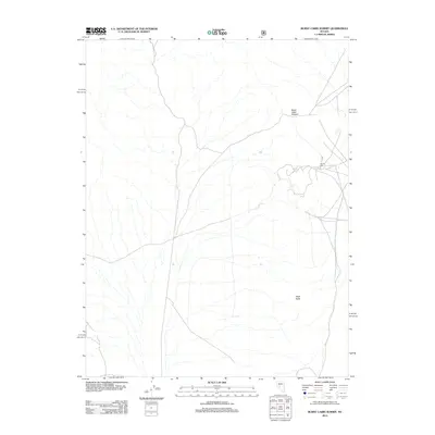
2012 Map of Burnt Cabin Summit
USGS Topo · Published 2012About this map
Bruner Mill stands as a focal point for the mining and industrial history within this remote section of Nye County, located on the eastern edge of the quadrangle. This 2012 topographic survey by the U.S. Geological Survey documents the high-elevation terrain of the Toiyabe National Forest area, where the landscape is defined by drainage networks and significant high points like Burnt Cabin Summit. In the southern portion of the sheet, Black Butte provides a prominent landmark among the complex system of forest roads and ephemeral watercourses. The network of unimproved roads and four-wheel-drive tracks suggests a landscape primarily used for resource extraction, ranching, and backcountry access, rather than concentrated settlement.
Find a feature on this map
3 named features on this map. Tap any name to fly to it.
Don’t see what you’re looking for? This feature index may not catch every label — zoom into the map to look around manually.
Map Details
Editions of this 2012 Burnt Cabin Summit Map
This is the sole edition of this map. No revisions or reprints were ever made.
Other maps of this area

1907 · Tonopah
USGS Topo · 1:250,000

1908 · Tonopah
USGS Topo · 1:250,000

1948 · Paradise Peak
USGS Topo · 1:62,500

1948 · Ione
USGS Topo · 1:62,500

1950 · Paradise Peak
USGS Topo · 1:62,500

1950 · Ione
USGS Topo · 1:62,500

1955 · Millett
USGS Topo · 1:250,000

1956 · South Shoshone Peak
USGS Topo · 1:62,500

1956 · Tonopah
USGS Topo · 1:250,000

1959 · Tonopah
USGS Topo · 1:250,000