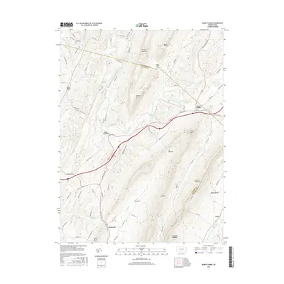
2016 Map of Burnt Cabins
USGS Topo · Published 2016About this map
Fort Littleton and the historic settlement of Burnt Cabins anchor this landscape where the ridges of the Appalachian Mountains converge. The terrain is defined by the steep slopes of Shade Mountain, Blacklog Mountain, and Tuscarora Mountain, creating natural corridors like The Narrows and Allens Valley. These valleys have long dictated the path of travel, from early frontier outposts to the modern highway system that cuts through Sheepskin Hollow. Local history is preserved in sites such as Cromwell Church Cem and the Fort Littleton Cemetery, which serve as markers of the area's early settlement.
Find a feature on this map
83 named features on this map. Tap any name to fly to it.
Don’t see what you’re looking for? This feature index may not catch every label — zoom into the map to look around manually.
Map Details
Editions of this 2016 Burnt Cabins Map
This is the sole edition of this map. No revisions or reprints were ever made.
Other maps of this area

1900 · Mercersburg
USGS Topo · 1:62,500

1902 · Mercersburg
USGS Topo · 1:62,500

1925 · Needmore
USGS Topo · 1:48,000

1930 · Broad Top
USGS Topo · 1:62,500

1933 · Broad Top
USGS Topo · 1:62,500

1935 · Needmore
USGS Topo · 1:62,500

1939 · Needmore
USGS Topo · 1:62,500

1939 · Orbisonia
USGS Topo · 1:62,500

1940 · Orbisonia
USGS Topo · 1:62,500

1942 · Hagerstown
USGS Topo · 1:125,000
Featured Places
- Metal Township, PA
- Burnt Cabins, Dublin Township
- Clear Ridge, Dublin Township
- Fort Littleton, Dublin Township
- Licking Creek Township, PA